While Hong Kong is synonymous with skyscrapers, shopping and sophisticated bars and restaurants, there’s another side to the city that’s loved by residents – the fantastic hiking! On weekends especially, many expats and locals take to the trails to combine getting active with enjoying the views and fantastic countryside. There are plenty of hikes and walks to choose from, for all abilities, from easy family-friendly walks and circuits to longer walks, and some challenging hikes for the super fit! Here’s a dozen we’ve tried and a rough estimate of how long they are to help you get going!
#1 Best family-friendly walks and hikes in Hong Kong (under 2km)
Ping Shan Heritage Trail
This is a flat 1.6km route in the New Territories, which has the added bonus of being educational. Hong Kong’s first-ever heritage trail features historic buildings belonging to the Tang family; they were the early settlers of the area, and the first and most powerful of the ‘Five Clans’. Highlights along the 1km trail feature the city’s oldest pagoda, a temple, a gallery and an old colonial police station.
Getting there: MTR to Tin Shi Wai Station and take Exit E. Cross Tsui Sing Road to Tsui Sing Lau Pagoda, from where the trail starts.
Tai Tam Reservoir Family Walk
This 1.6km walk starts at Tai Tam Reservoir Road, about 15 minutes from Parkview Mansions. The middle section intersects Tai Tam Reservoir Road where you can stop for a picnic; otherwise, continue on and get a panoramic view of Tai Tam Reservoir, before the hike ends at Tai Tam Reservoir Road.
Getting there: Number 14 bus from Sai Wan Ho MTR Exit A bus stop; get off at Tai Tam Country Park, Tai Tam Road; the trail starts across the road.
Ma On Shan Family Walk
This little hike is less than 1km, and will take about half an hour, so it’s a great entry level hike for young families. The hike starts inside a barbecue site near Ma On Shan Tsuen Road, through an arch at the right-hand side of the barbecue. Head up the small hill and you’ll see the top of Ma On Shan; then follow the loop back to the barbecue site.
Getting there: The easiest is way is to take a taxi from Ma On Shan MTR; there are minibuses too, or it’s a 45-minute uphill road walk to the start (which kind of defeats the purpose if you’re trying to keep the family-friendly element in play!).
Tai Mei Tuk Family Walk
This stroll alongside Plover Cove Reservoir extends for around 1km and takes approximately an hour. The kid-friendly trail leads you through Tai Mei Tuk, a pretty recreation area at the foot of Mount Pat Sin Leng. Start your adventure at Bradbury Jockey Club Youth Hostel, a stone’s throw from the scenic Plover Cove. The walk passes by 12 columns that represent signs of the zodiac; you’ll also come to several viewing points. There are spectacular views across the reservoir towards Ma On Shan, towering over the far side of Plover Cove.
Getting there: Take the 20C minibus from Tai Po Market Station to Tai Mei Tuk bus terminus.
Sheung Yiu Family Walk
This is a good option if you’re looking for family-friendly hikes in the Sai Kung area. Total distance is around 1.8km, starting at Sheng Yiu and ending at Tai Mong Tsai Road. The trail starts about 200m south of the Sheng Yiu Folk Museum. Turn left and head uphill onto the tree-lined path. The middle part of the walk is quite level, so it’s nice for a picnic; or you can continue the walk until you reach the barbecue sites. From the end of the walk at Tai Mong Tsai Road, it’s about a 20-minute walk back to Pak Tam Chung where you can get public transport.
Getting there: Bus 94 from Sai Kung; get off at the stop for Pak Tam Chung Village.
#2 Best hikes in Hong Kong for a longer walk (2 to 5km)
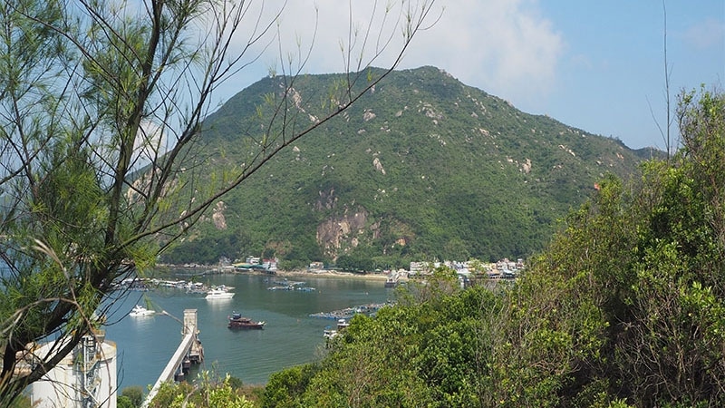
Lamma Island
As the name suggests, the Lamma Island Family Walk is suitable for the whole family; plus, you get to enjoy the ferry ride to and from the island itself. The hike is quite flat and runs for around 5km between the two villages on Lamma, both serviced by ferries from Central.
Start at Sok Kwun Wan and make your way to Yung Shue Wan, where you can poke around the shops and market stalls before enjoying a meal at one of the waterfront restaurants. Along the way you’ll pass the 150-year-old Tin Hau temple, the Lamma Island Pavilion and Hung Shing Yeh Beach, as well as getting a view of the Lamma Wind Turbine and Power Station. You can also start at Yung Shue Wan and head back the other way. Estimated time for the walk is two hours for those with kids, and significantly less if you’re on your own or a strong walker.
Getting there: Take a 30-minute ferry ride from Central Pier 4 (MTR Hong Kong Station Exit E1, walk through ifc mall and the footbridge) to Sok Kwu Wan or Yung Shue Wan.

Bowen Road
This is an easy hike, but it’s a good one if you have particularly young kids, as it’s so flat that it’s stroller-friendly. It’s also good for kids on scooters and bikes. Plus, the views over Happy Valley, Wan Chai and Central are spectacular. The full trail is under 4km, but there are little shrines and a playground to keep the spirits up among the smaller members of your crew!
Getting there: Start your walk either the Happy Valley end, with an entrance from Stubbs Road, or from the corner of Bowen and Magazine Gap Roads.
The Peak
The Peak Circle Walk takes the prize for the family-friendly hike with the best views! The 3.5km walk begins at Lurgard Road near the Peak Tower. Twenty minutes of walking on Lugard Road will get you to the Lugard Road Lookout. Lugard Road runs into Harlech Road, where another 15 minutes will take you back to the Peak Tower. You can then take the tram or bus back down the Peak.
Getting there: Head up via the Peak Tram, or take the #15 bus from Exchange Square bus terminus.
#3 Best hikes in Hong Kong if you’re fit! (over 5km)
Dragon’s Back
This is one of those hikes on everyone’s Hong Kong bucket list – you really should do it at least once if you live here. It’s a relatively easy ridge-line hike with only a few areas with rough steps and some climbing at the start, though at 8km in length it’s more than just a walk in the park.
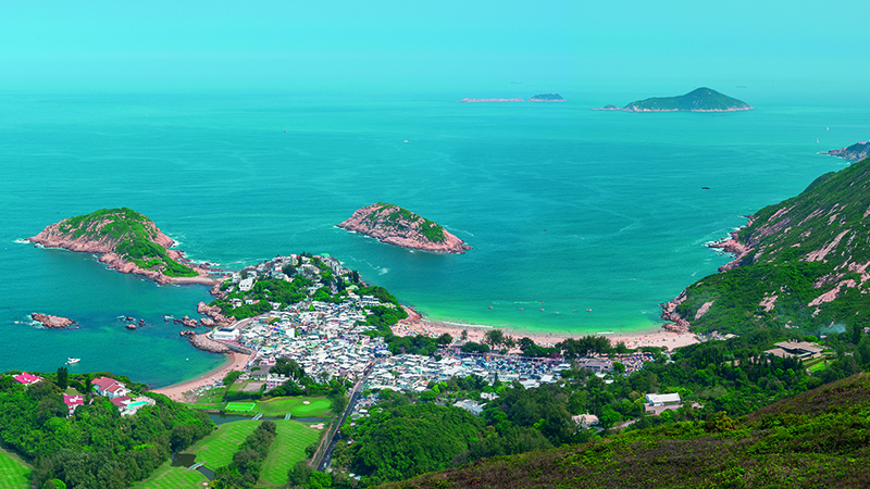
Start the hike at the beautiful Hong Kong Trail Section 8 entrance on Shek O Road. After 20 minutes, you’ll have a view over Shek O beach to the east and the ‘Dragon’s Back’ to the northeast. Continue to the viewing platform on Shek O Peak. If you want to conquer the dragon, follow the rolling ridge from Shek O Peak to Wan Cham Shan. You can then continue on to Big Wave Bay as your final destination. Estimated time for the full hike is about four hours.
Getting there: Walk from MTR Shau Kei Wan Station Exit A to Shau Kei Wan Bus Terminus. Take bus 9 or the minibus with the sign ‘Shek O’ next to the bus terminus. Alight at To Tei Wan, Shek O Road.

Lantau Peak
The second-highest spot in Hong Kong, Lantau Peak is on every serious hikers must-do list. It’s particularly popular as a place to watch the sunrise but you’d need to set off about 4am to catch a 6am sunrise.
There are different ways to approach the summit from the Lantau Trail, but one good starting point is from Section 3, at Pak Kung Au. The hike takes in the top of the mountain (934m high), and then descends to Ngong Ping and the Big Buddha (approximately 6.5km). December to February is considered the best time for photography as there are fewer clouds and less haze. Estimated time is two to three hours, and there are some steep areas.
Getting there: From Tung Chong MTR, take the 3M bus and ask to be let off at Pak Kung Au.
Ma On Shan to Sai Kung
Like a climb? This 7km hike on Ma On Shan has plenty of ascent; the summit of the mountain, whose name means “horse saddle”, is over 700 metres – it’s one of Hong Kong’s ten highest peaks. After starting in Ma On Shan Country Park, you hike up Tiu Shau Ngam to a first peak known as The Hunch Backs, before crossing a one-kilometre saddle to the top of Ma On Shan. The hike continues south toward Sai Kung, passing Pyramid Hill and Ngong Ping Viewing Point, and includes one small stretch of Section 4 of the Maclehose Trail.
Getting there: For the starting point, see the details for the Ma On Shan Family Walk, above. Note: This hike is a one-way route ending in Sai Kung, from where there are easy options back to the city.
Sai Kung Peninsula Hike
This hike covers Section 1 and part of Section 2 of the MacLehose Trail, providing one of the best ways to see the volcanic columns of High Island. The route also passes the High Island Reservoir and Long Ke Wan, which have been voted as two of Hong Kong’s best scenic sites.
Section 1 of the trail takes you into the lower half of the Sai Kung East Country Park; it mostly consists of flat roads and concrete paths, so it’s doable with the whole family. But Section 2 is considerably more up and down, and, with the whole route being around 14km, it’s likely to be too much for younger children.
Getting there: From Sai Kung Town, take bus 94 or 96R (Sundays and public holidays) for Wong Shek Pier, getting off at Pak Tam Chung Station. From the Pak Tam Chung Barrier Gate, walk along Tai Mong Tsai Road for five minutes to the trail head.
Also … Some hiking tips
Remember when hiking to take appropriate precautions. Plan your route in advance (including public transport options), wear appropriate clothing and carry water. Ensure you have the correct fitness level for the hike you’re attempting. And remember: not all areas have mobile phone reception. The Hong Kong Agriculture, Fisheries and Conservation Department has comprehensive safety advice. Remember to download the government app Enjoy Hiking and to activate the tracking service before hitting the trails.
Looking for more Things To Do in Hong Kong? Read on!
Top things to see and do in Hong Kong
Traditional festivals and events in Hong Kong


